Ascent to Pyšný štít
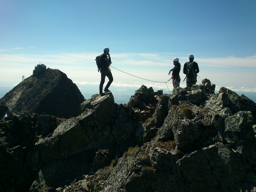
Pyšný štít is located between Malá Studená dolina and Medená kotlina and it’s the biggest peak in the ridge from Baranie rohy to Lomnický štít with an altitude of 2623 meters above sea level. It is adjacent to Malý Pyšný štít. They are separated by a Pawlikowského štrbina and Lastovičia štrbina, between which there is a rock needle Loktibrada.
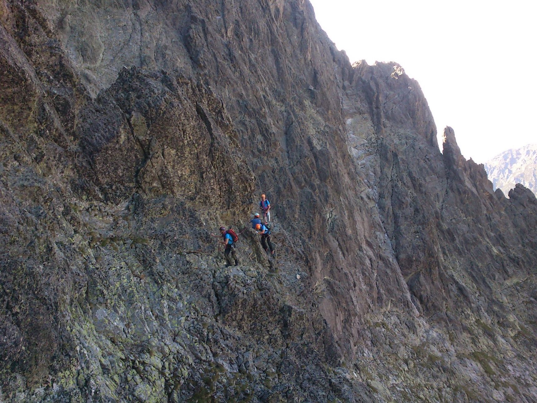
Climbing it is one of the most challenging. The classic route starts at Hrebienok, from where we ascend along the marked hiking trail to Téryho chata.
From there, the ascent follows as the route Jordánova cesta, but higher in the couloir we turn into Bachledova štrbina and ascend to the peak Pyšný štít.
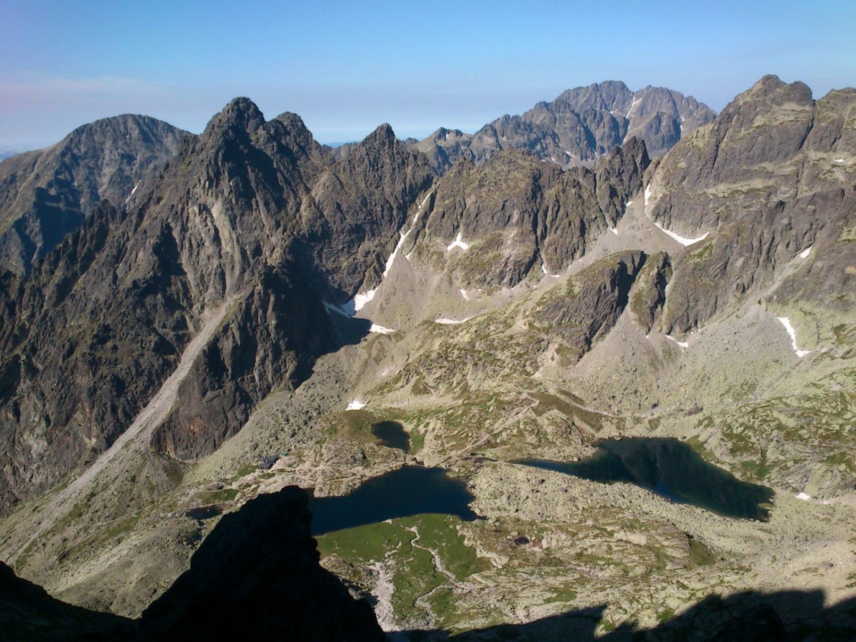
From the top of Pyšný štít we descend back along the ascent route, or we can descend to Téryho chata via Malý Pyšný štít. From the top we have wonderful views of the entire Malá Studená dolina with all the tarns Spišské plesá, from the other side we see, for example, the tarn Zelené pleso and the Belianske Tatras.
The more advanced can choose to ascend to Pyšné štíty. They’ll first ascend to Malý Pyšný štít, then to Pyšný štít with a transition along the ridge to Lomnický štít with a descent route to Lomnické sedlo.
Total Ascent: 1400m
Difficulty: medium to difficult
Duration: circa 10 hours
You can choose your mountain guide here:
Mountain Guide Association High Tatras
The Mountain Guides Association brings together leaders with a valid international certificate UIAGM-IVBV-IFMGA, which are abbreviations for the worldwide Union of Mountain Guides. They provide leadership and guide services in mountainous terrain throughout the year. In addition to guide services, they also organize ski mountaineering tours, ice climbing, avalanche courses, etc.